Canyon Creek, B.C., Canada
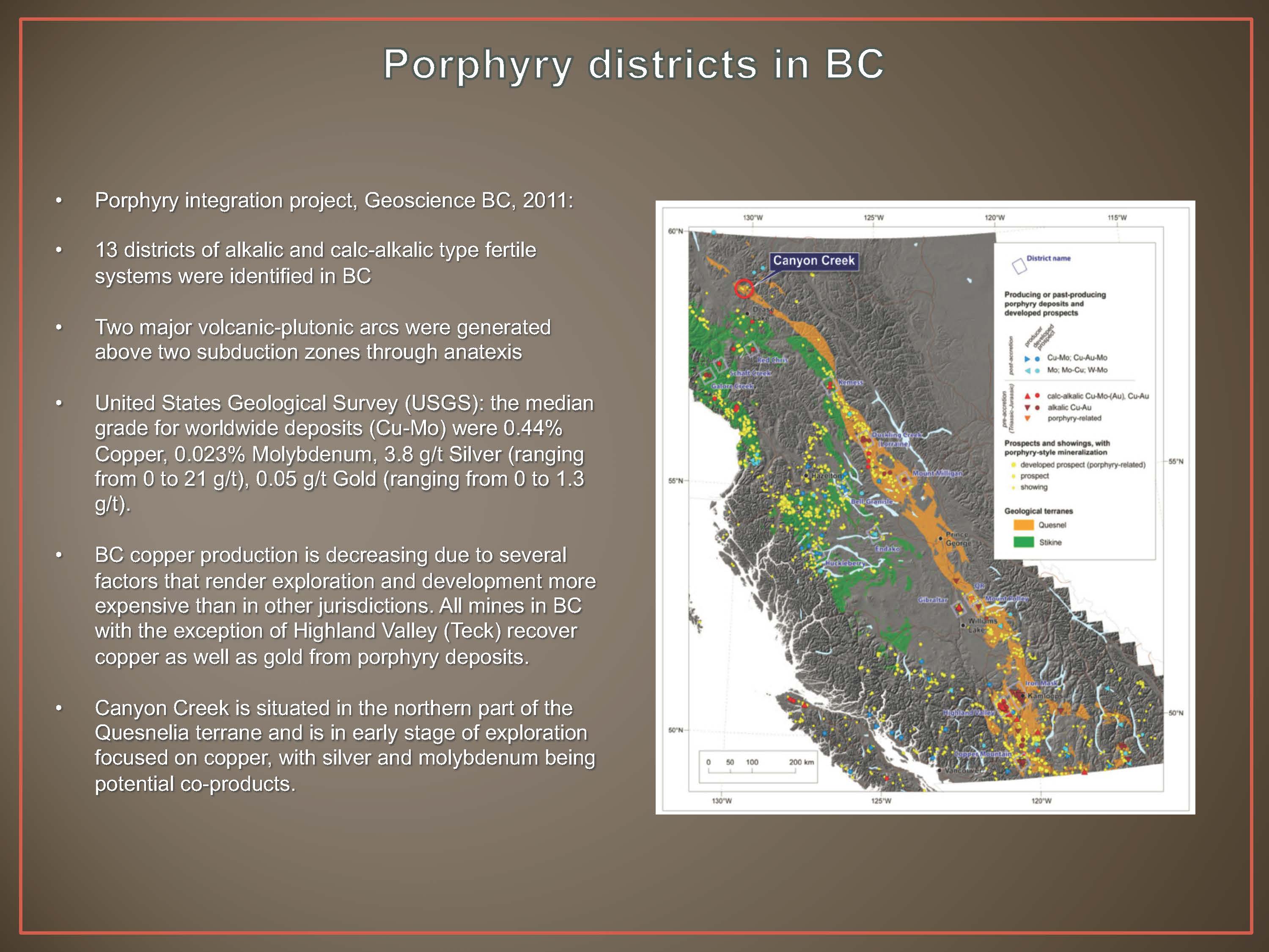
The Canyon Creek property is located in the northwestern end of the Quesnelia Zone (Terrane) approximately 160 kilometres (“km”) from the Red Chris Mine, 15 km from a main highway and 60 km from the town of Dease Lake.
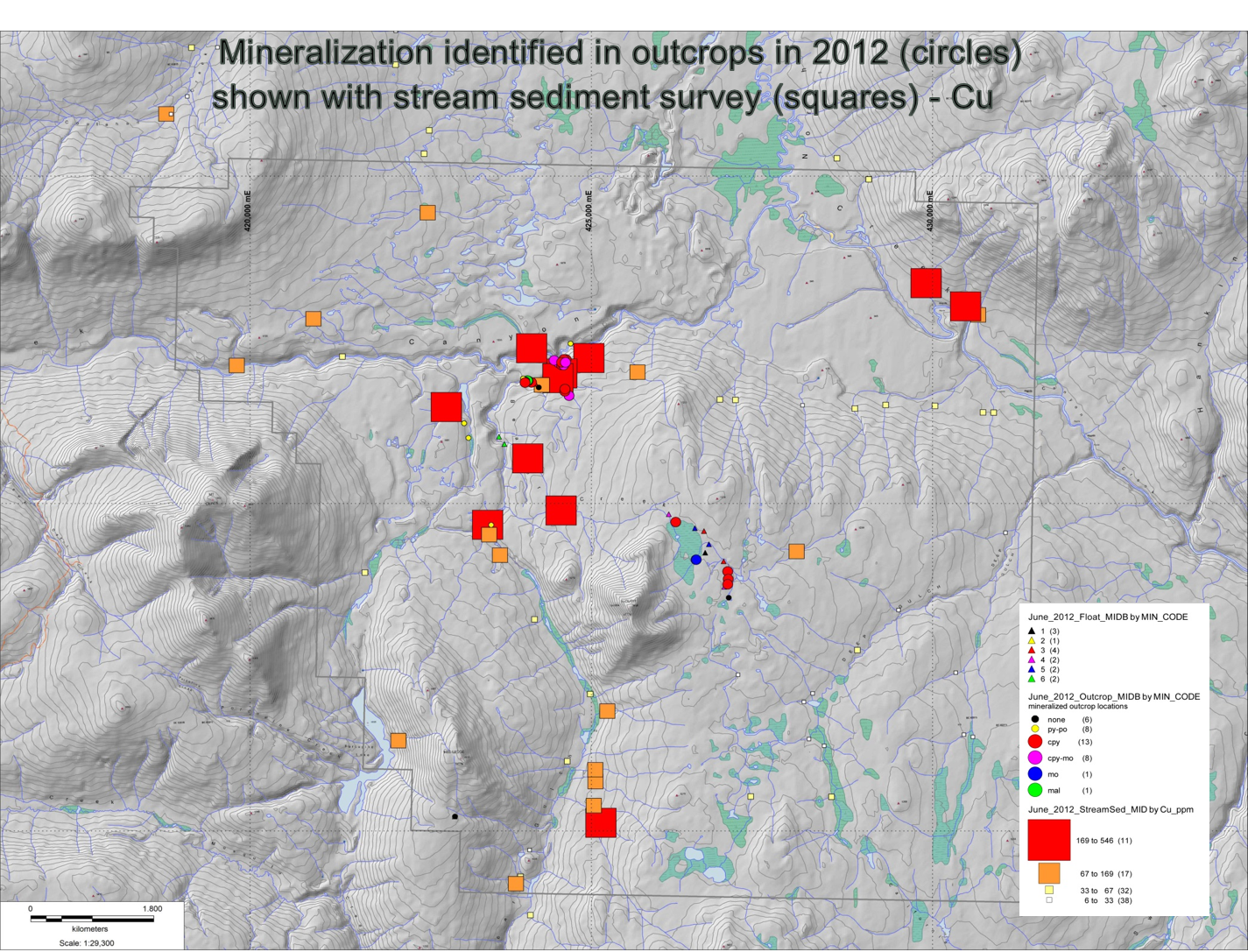
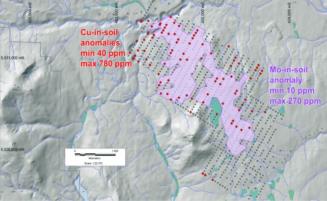
Canyon Creek comprises 24 square kilometres covering a discrete bullseye copper-molybdenum- silver anomaly delineated by regional stream sediment survey. The property also covers large areas with anomalous levels of molybdenum (“Mo”) and copper (“Cu”) in soils extending over 5 km by 2 km and is open. Mo ranges from 10 to 270 parts per million (“ppm”) and Cu ranges from 40 to 780 ppm.
Prospecting has identified two separate zones of Cu and Mo mineralization, in outcrops of quartz veining and stockwork zones containing chalcopyrite (copper sulphide) and molybdenite (molybdenum sulphide). These two areas cover 800 metres (“m”) by 300m and 400m by 400m, respectively. Mineralization, found on surface to date, grades up to 1.56% Cu; up to 0.1% Mo and up to 17.6 grams per tonne (“g/t”) silver (“Ag”).
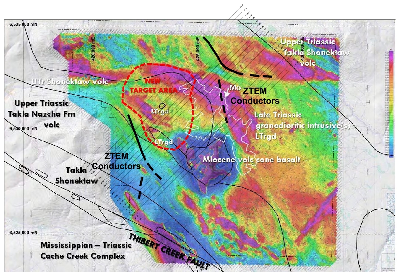
The mineralization, soil anomalies and geophysical anomalies appear to be associated with an altered quartz monzonite porphyry which intrudes rocks of the Quesnel Terrane. Large granodiorite to quartz monzonite plutons are affiliated with the Quesnel Terrane of B.C. Overall, quartz-monzonite plutons form the largest world class deposits of Cu-Mo-Au and Cu-Mo. Examples are Edernet with 1.78 billion tonnes of 0.62% Cu and 0.025% Mo, Chuquicamata, 6.45 billion tonnes of 0.55% Cu and Bingham Canyon, 3.24 billion tonnes of 0.88% Cu, 0.02% Mo and 0.5 g/t Au. *There are no assurances that similar results would be obtained on Alta Copper’s Canyon Creek Property.
The property is also situated adjacent to a major NNW striking fault (the Thibert Fault) and close to a 70 km long E-W striking lineament.
Previous Exploration
Over $1 million has been spent at Canyon Creek by previous explorers dating back as far as 1971 when Dolmage Campbell/UMEX conducted IP and ground Magnetics and apparently drilled 4 holes, although this has not been verified. Since then, Cassiar Asbestos Corp. (1971), Noranda (1978), Paget Resources (2008) and Sirius Resources (2012) have conducted stream sediment and soil sampling; geological mapping, prospecting and rock chip sampling; airborne Fugro MAG (1317 line km); ZTEM (200 line km). There is no evidence that any of these groups conducted any drilling.